
TUG VALLEY AREA CVB
The Tug
Fork River
Serving as the state border between West Virginia & Kentucky, the "mighty tug" is quickly becoming a destination of itself for fishermen and kayaking fans alike.
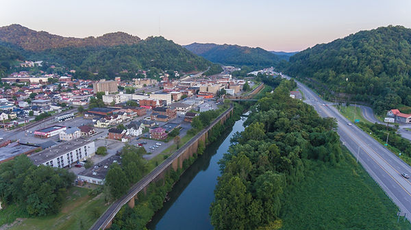
Williamson, West Virginia (Left), The Tug Fork River (Center), and US-119 (Right)
History of "The Tug"
The Tug Fork River stretches 159 Miles long from close to the Virginia state line in McDowell County, West Virginia to Louisa, Kentucky where it joins the Levisa Fork to form the Big Sandy River.
Because of this, the Tug Fork is considered to be part of the Mississippi River watershed. Uniquely, the Tug Fork is one of the rare rivers that flow north.
The origins of its name were noted by Toponymist George R. Stewart as in 1756, a small army of Virginians and Cherokees conducted war raids against the Shawnee. At one point, they killed and ate two buffalo and hung their hides from a tree. The later took these hides and cut them into thin strips called "tugs".
Stewart noted another possible origin, perhaps more accurate. In the Cherokee language, "tugulu" refers to the forks of a stream, as in the Tugaloo River and other streams in former Cherokee lands named "tug".
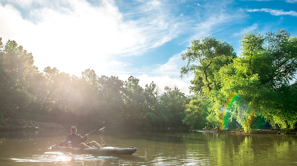
Kayakers float down the Tug Fork River beside South Williamson, Kentucky.
Suggested Trips:
-Downtown Williamson to Goodman Hollow
Easily the most popular kayaking trip in the Williamson area, this 3.7 Mile Float takes around 3 Hours and is perfect for beginners and advanced users. There are plenty of places to stop along the way and take in the views of the valley!
-Downtown Williamson to Chattaroy
Slightly longer than the trip above, the route to Chattaroy is 4.9 Miles.
Various Mileage Notes from Williamson:
-5.8 Miles to Sport Stop, Inc.
-7 Miles to Borderland Ramp
-8.6 Miles to Nolan Toll Bridge
-10.6 Miles to Millers Creek
-12.5 Miles to Maher Cemetery
-13.5 Miles to Maher Rail Crossing
-15.8 Miles to Naugatuck
HIGHLY IMPORTANT - PLEASE READ:
For anyone enjoying water recreation in the Williamson area, there is a low-water dam located on the southern end of the downtown district adjacent to the Williamson Water Plant. It is NOT possible to float over nor pass by the dam. ALL watercraft must exit the Tug Fork River at the Water Plant and put back in below the dam.